Ski Maps
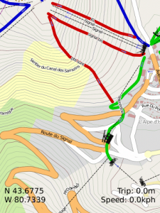
Get maps of your favourite pistes on your phone. The app provides maps for most ski resorts around the world. The application uses your phones GPS to show you where you are, what direction youre skiing in, what your speed is and the route that youve skied so far. You can see the route youve skied on your phone and download it to your computer and map it on Google Earth. The track youve skied is exported in the popular GPX format and contains speed and elevation. You can also quickly navigate back to fixed points such as where you parked your car or your favourite spot for lunch by marking the spot.
Zoom in with the 1 and 3 keys or the volume controls.
Maps are based on openpistemap.org please checkout the website to see what maps in your area look like.
Application loads instantly excluding map downloads
Smooth interface
Waypoints export in GPX format with track
Find your car by marking it on the map
Records track, exports to GPX format map them in Google Earth at aztux dot com
Trip meter/odometer see how far youve travelled.
Speedometer
Compass
Search feature
Multiple units km/miles
Lattitude and Longitude display
App Name:Ski Maps
App Version:1.0.0
App Size:83 KB
Cost:US$3.99 USD