Aviation Weather – USA
The application has the following capabilities:
Direct Entry TAFs METARS, Decoded, for anywhere in the world.
Decoded TAFs METARS for US from list.
Weather Depiction: Current plus 00Z and 12Z in the future.
Current SIGMETS Graphical and Text.
IFR/Mountain Obscuration Chart.
Direct Entry, text based PIREPS with radius search parameter.
Center Weather Advisories for all ARTCC locations.
Convective outlooks for the next 48 hours.
Clouds below 6,000 Ft chart showing moisture types present within cloud.
National Surface Observations Chart.
Freezing Level Charts: Current, +12, +18 HRs.
Synoptic Charts CUrrent and +24 Hours.
Current Winds charts SFC, 5,000, 10,000 34,000.
Animated National Radar with regional drill down.
Current National Radar w/tops.
Regional Radar Imagery for all areas of the lower 48.
Animated National Satellite imagery with regional drill down.
Current GOES Satellite images Visible, IR and WV.
Prog and Precip Charts for +12, +24 +36 hours in the future.
Winds Aloft from 3,000 through 39,000 feet Current and +12 Hours.
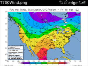
Constant Pressure Charts for 850mb, 700mb, 500mb, 300mb and 200mb.
Lifted Index plus Cape, Convergence and Heliocity Charts.
Direct access from the application to FAQs and EMAIL Support.
This application displays information obtained from free internet weather sites in order to avoid having to charge you a monthly access fee.
App Name:Aviation Weather – USA
App Version:3.0.0
App Size:17 KB
Cost:US$9.99 USD