LGE KU Outage Maps
The LGE and KU outage maps provide snapshots of current outages throughout the companys system. The maps, which automatically update every few minutes, contain details about the cause of an outage as well as the number of customers affected.
LGE and KU recognize this is critical information for our customers, and now you can access it on the go.
Outage Map How it Works
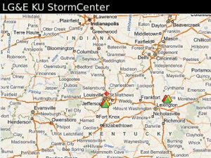
The outage maps use colorcoded symbols that indicate the number and general location of customers without service.
The Legend button provides an overview of the colorcoded outage symbols.
The Summary button provides additional information by county and zip code in an easy to read table format. Data can be sorted numerically or alphabetically by clicking on a column title.
Selecting the colorcoded symbol on the map will provide specific outage information, including:
The number of customers affected
The time of the earliest outage report
The estimated restoration time
The cause of the outage if known
App Name:LGE KU Outage Maps
App Version:1.0.15.2
App Size:764 KB
Cost:FREE