SARtrek
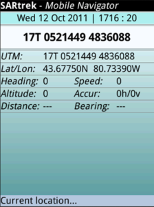
SARtrek is a GPS location and mapping program designed specifically for use in Search and Rescue operations. It reports position information in UTM Universal Transverse Mercator grid coordinates, full UTM coordinates and latitude/longitude, as well as heading, speed, altitude and accuracy. It may be useful for other landbased applications such as hiking, geocaching, etc., especially where the primary coordinate system being used is UTM. It supports NAD27, NAD83 and WGS84 datum conversions. It stores trackpoints that can be added manually or recorded automatically at a set interval. It interfaces with Google Maps if installed to identify the current location or any stored trackpoint location in either Map or Satellite view mode.
Please note that this application was designed to run on BlackBerry using OS 6.0 or higher. It has been tested on the BlackBerry Bold, the Torch and the Storm.
App Name:SARtrek
App Version:2.0.2
App Size:90 KB
Cost:US$9.99 USD