Ultimate Maps
Beautiful, highly detailed maps in a fast and responsive app, that also supports a host of other GPS related features.
Whether you want a simple map application or something to go Geocaching with Ultimate maps is it. Providing detailed maps of most of the world, including not just roads but other features such as walking paths, cycle routes, bus and train stops, businesses etc. Maps are based on openstreetmaps.org please checkout the website to see what maps in your area look like before buying
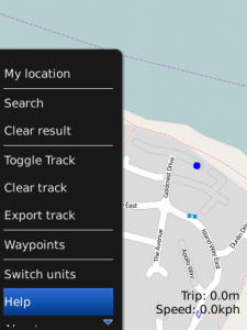
If your phone has GPS then then app will show you where you are, what direction youre walking/driving in and what your speed is. Quickly navigate back to fixed points such as where you parked your car or your friends house by marking the spot.
Use the volume control to zoom in and out or use the number 1 and 3 keys.
Application loads instantly excluding map downloads
Smooth interface
Waypoints export in GPX format with track
Find your car by marking it on the map
Records track, exports to GPX format map them in Google Earth at www.aztux.com
Speedometer speed display
Compass direction indicator
Search feature for finding addresses and attractions
Multiple units km/miles
Lattitude and Longitude display
App Name:Ultimate Maps
App Version:1.0.7
App Size:86 KB
Cost:US$3.99 USD