Marine Weather – Northeast Coast
Northeast Coast Marine Weather provides, via the BlackBerry browser, up to date weather data for the US and Canadian boater. This application displays information obtained from free internet weather sites in order to avoid having to charge you a monthly access fee.
The available information includes:
Current Forecast Atlantic Sea Surface Temperatures.
Current Forecast Surface Wind Speeds and Direction.
Current Forecast Wave height and swell direction.
Animated Color Radar w/watch boxes, warnings and drill down.
Animated,color regional Radars from Main to North Carolina.
US Visible, IR, Water Vapor and animated color satellite imagery.
Canadian Visible and IR Satellite Imagery.
Current US Canada Barometric Pressure Isobar Chart.
Current US Canada Synoptic Weather Map.
Forecast Weather Maps +12, +24 +48 hours.
Forecast Precipitation Maps +12, +24 +48 hours.
Severe Weather forecasts Current day and +24 Hours.
Hurricane/tropical storm charts and text forecasts
Buoy Reports from Maine to Virginia.
US NE Coast Tide Utility
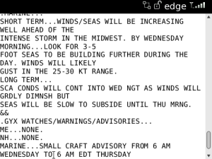
Hazardous Weather Marine Forecasts.
Short Term Forecasts.
Area Weather Discussions.
Open Waters Forecasts.
Near Shore Forecasts.
Marine Messages.
Marine Statements.
Marine Warnings.
Maritimes, Newfoundland Labrador Marine Messages.
Maritimes, Newfoundland Labrador Synopsis.
App Name:Marine Weather – Northeast Coast
App Version:3.0.0
App Size:10 KB
Cost:US$9.99 USD